Tahiti South Pack
Tahiti South Pack :
After the succes of Caribbean Pack
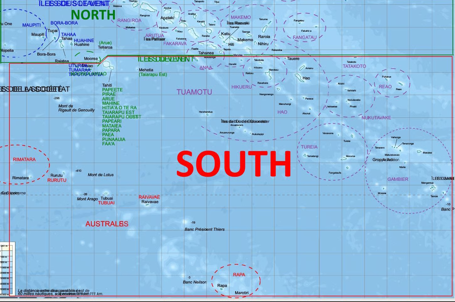
Let's fly South of Tahiti : One product for all. From Papeete to Mangareva.
Ticket for Paradise ?
Cheaper and faster than real !!!
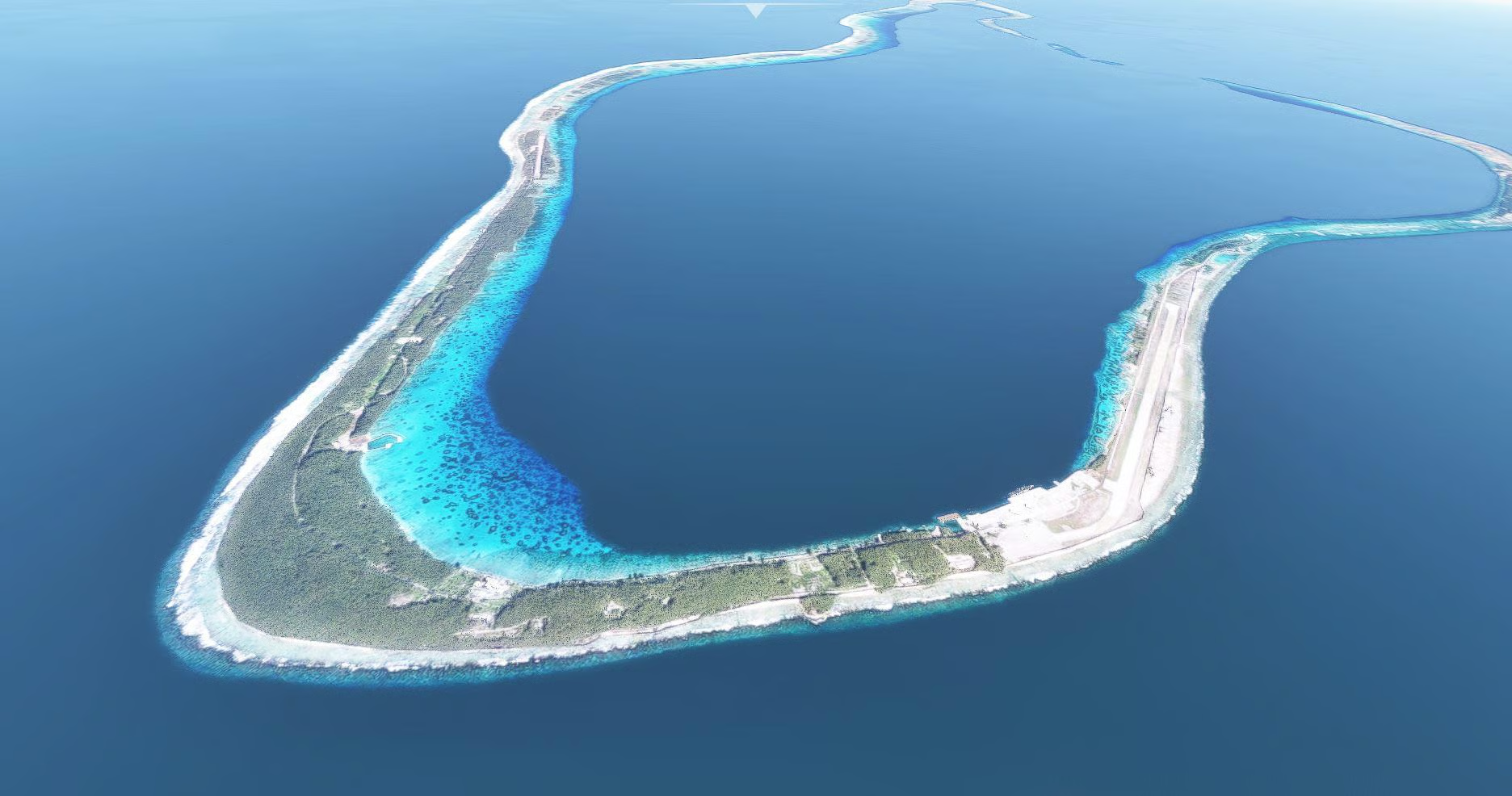
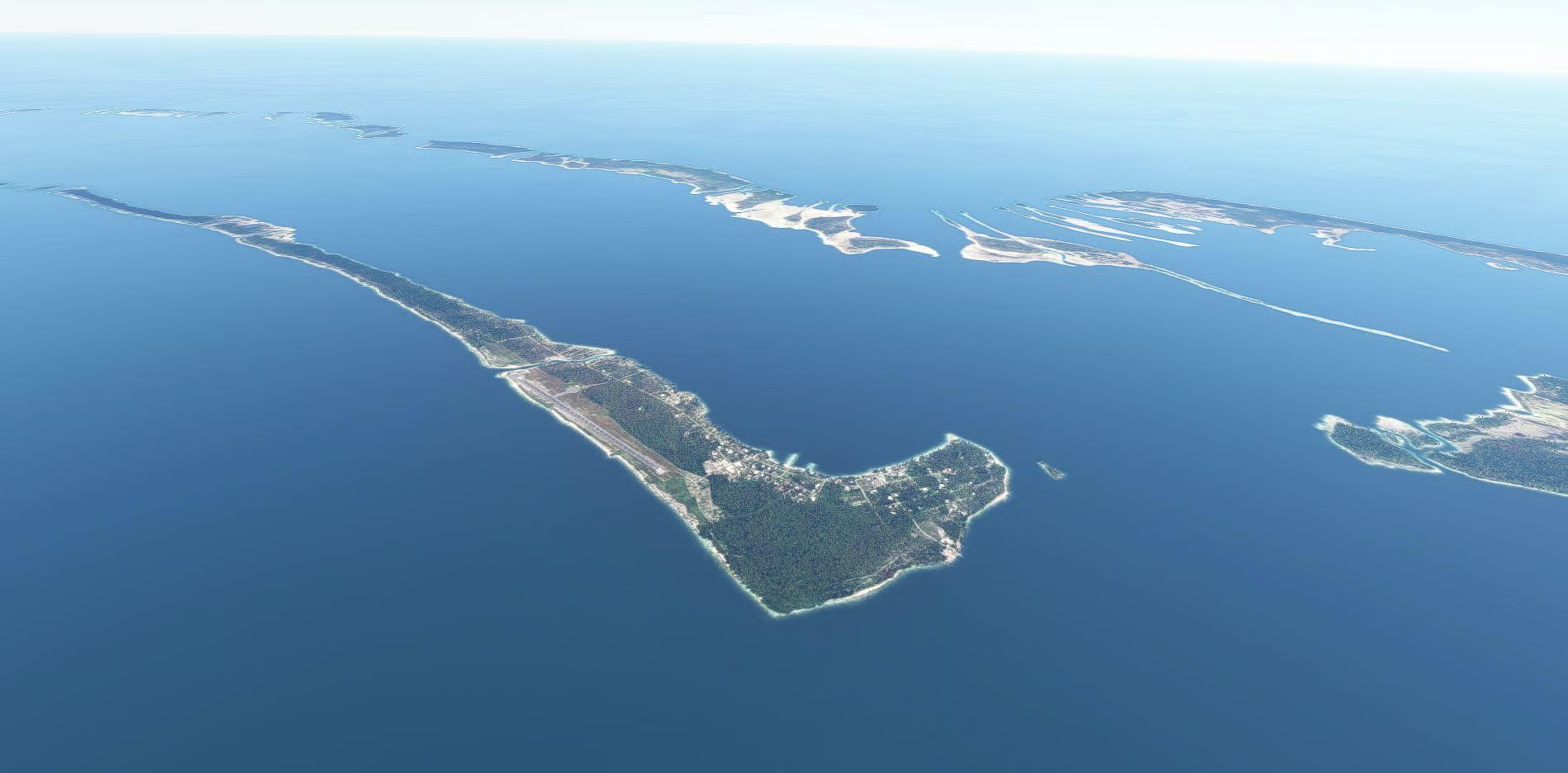
Experiment 18 airports and 46 Islands/atoll in one pack.
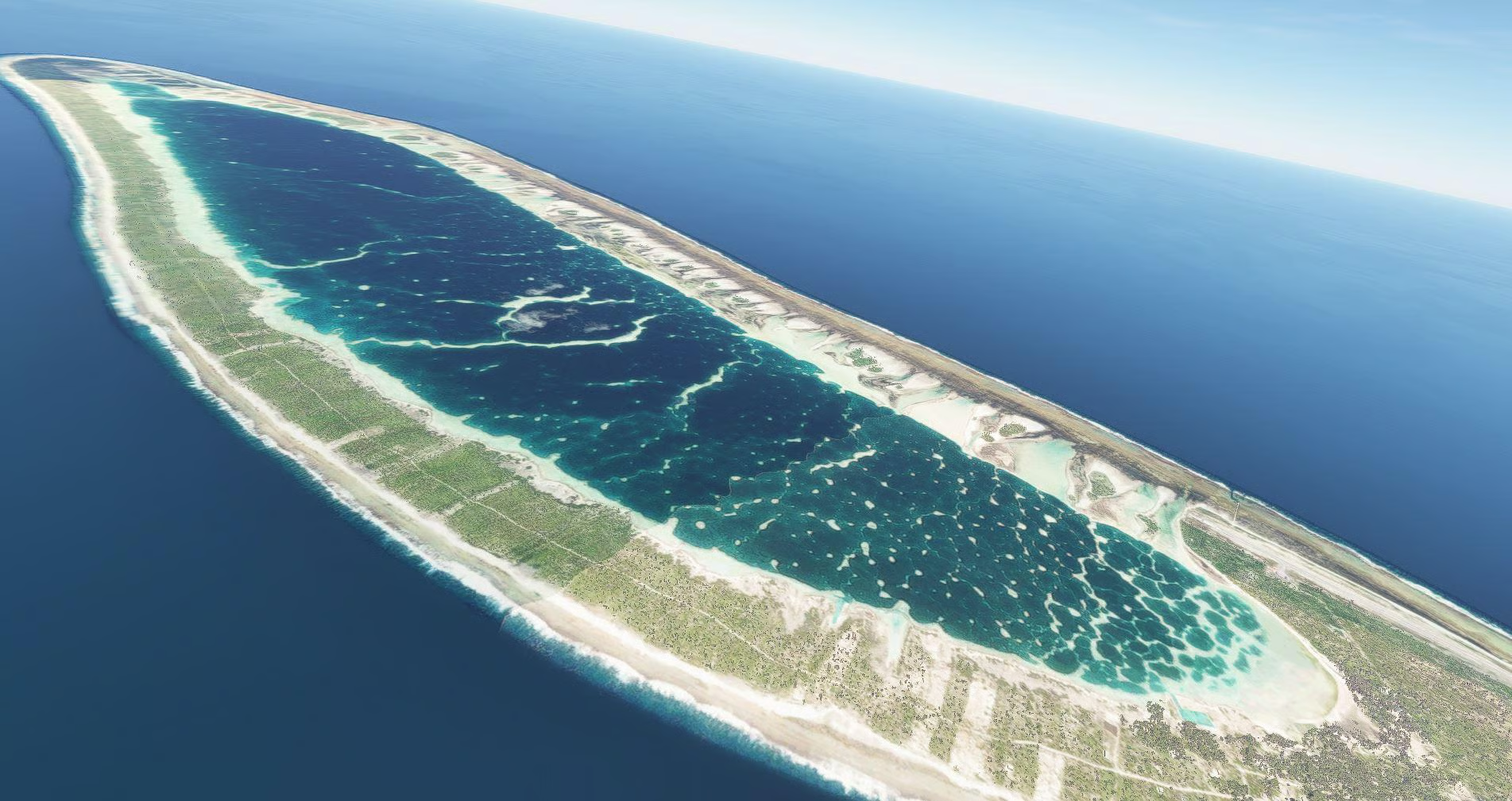
The pack cover all the south part of french polynesian islands and is the most detailed scenery ever build for a flight simulator for this area.
From tahiti to Gambier Island. This include NTAA tahiti faaa international which is available as a single product too.
Fs2020 and Fs2024 (with small patch here) Compatible.
This is more than a scenery. This, trying to feel you there !
A 48 pages pdf documentation (in English, French and Deutch) is include
and give you information on particularity of all Islands. DOWNLOAD
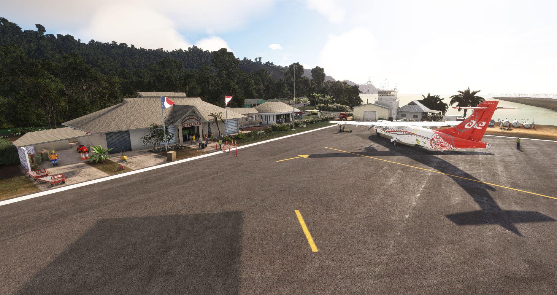
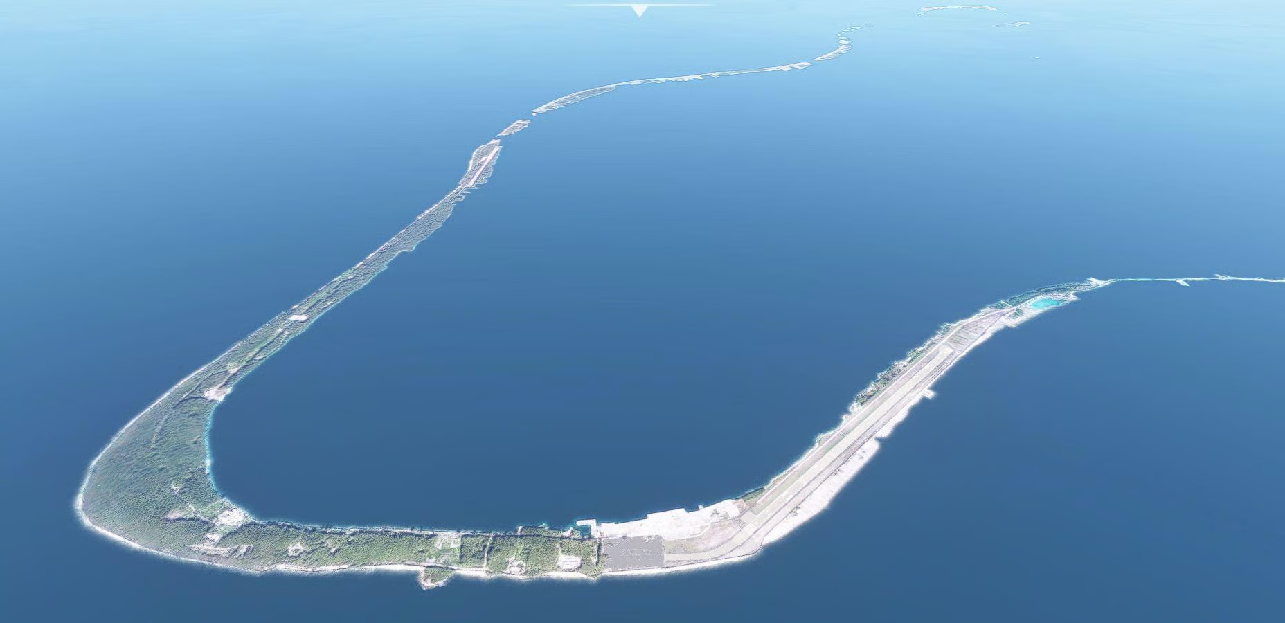
So you will see detailed Airports,
Landmarks, and ground photo replacing default when it's necessary,
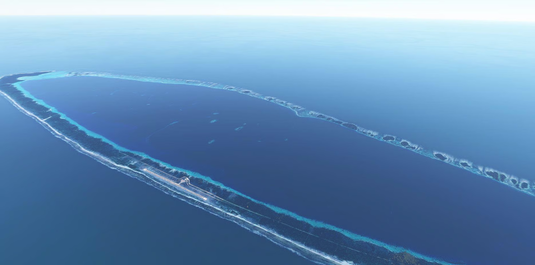
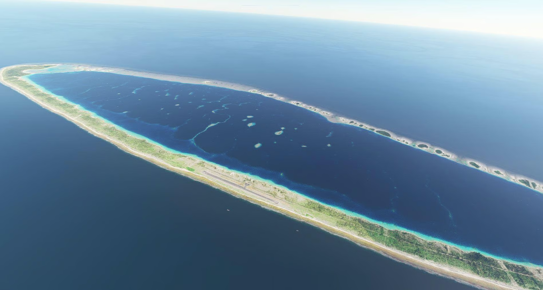
water mask on major atolls, water removed on other (Important : See more details below due to SDK),
Rework of all Vegetation on every islands, fauna, boats and every pontoons,
Animated people, fictitious helipad when atolls are distant, jet ski or traditional canoe...
Details :
Tahiti : NTAA,
Rimatara : NTAM, Bay of Virgins, temple, whale
Rurutu : NTAR, Whales
Tubuai : NTAT, animated sharks
Raivavae : NTAV, tortles
Rapa: Helipad
Atoll Hereheretue: helipad
Atoll Anuanuraro
Atoll Anuanurunga
Atoll Nukutepipi : NTKU, Luxury Resort
Anaa : NTGA, Church, animated sharks + dolphins
Atoll Haraiki : Helipad, animated sharks, tortles
Hikueru : NTGH, Church, animated sharks, tortles
Tekokota
Tauere : animated dolphins, tortles
Reitoru
Amanu : Helipad,animated sharks
Tatakoto : NTGO, Calvaire
Marokau
Ravahere
Nengo Nengo NTGG, private resort
Hao : NTTO
Manuhangi
Paraoa
Ahunui
Vairaatea : Helipad
Vahitahi :NTUV
Akiaki
Pinaki :helipad
Nukutavake : NTGW
Pukarua : NTGQ
Reao : NTGE
Vanavana
Tureia : NTGY
Moruroa : NTTX, Old French Nuclear Test Center ruins
Tematangi
Fangataufa
Tenararo
Vahanga : Helipad
Tenarunga
Matureivavao
Marutea Sud : NTGS
Maria : Helipad
Morane
Gambier islands : NTGJ, Cathedral, pearl farms
Temoe
World update 13 Oceania need to be up to date.
See information here for those using TAA antialiasing
Explore in deep, beautiful landscape ; Hours of flight are waiting for you !
Discover every major Landmarks of the area.
Discover each Island with a complete addon all in one.
Files are provided on separated files so you can use it or not.
IMPORTANT NOTE :
|
FRA Le SDK permettant de concevoir des scenery pour MSFS ne permet pas actuellement de rendre les récifs visibles et recouverts d'eau. (Donuts : Laisse l'eau au milieu et l'enlève uniquement où il y a des recifs) |
|
US The SDK allowing for the design of scenery for MSFS currently does not enable rendering reefs that are visible and covered with water. Since the purpose of this scene is to showcase the natural colors of these islands : 2 methods have been used. 1- Water mask: A photo is added floating above the water and semi-transparent to allow reflections and waves to show through. However, this requires a large file size and cannot be used for every island (used on the largest atolls). 2 - Total removal of water. This allows for the desired view of the reefs but removes the wave and reflection effects. Up close, the ground appears like land. At a distance of 100m, this detail is no longer visible, and the visual is more attractive than a completely blue expanse. Moreover, in reality: There are very few waves in the middle of the atolls. Donuts: Leave the water in the middle and only remove it where there are reefs. Below is a table indicating the methods used for each island and a link to test the output without water for free. However, you have the choice to allow the water to appear or not. |
|
GER Das SDK, das die Gestaltung von Szenerien für MSFS ermöglicht, erlaubt es derzeit nicht, die Riffe sichtbar und mit Wasser bedeckt zu machen. Da das Ziel dieser Szenerie darin besteht, die natürlichen Farben dieser Inseln zu entdecken, wurden 2 Methoden verwendet: 1- Wasser-Maske: Ein Foto wird fliegend über dem Wasser hinzugefügt und ist semitransparent, um die Reflexionen und Wellen sichtbar zu lassen. Dies erfordert jedoch eine große Dateigröße und kann nicht für jede Insel verwendet werden (wird auf den wichtigsten Atollen angewandt). 2 - Vollständige Entfernung des Wassers. Dies ermöglicht die gewünschte Sicht auf die Riffe, entfernt jedoch den Effekt von Wellen und Reflexionen. Aus nächster Nähe sieht der Boden wie Land aus. Ab 100 m sieht man dieses Detail nicht mehr und das Bild ist schöner als eine völlig blaue Fläche. Darüber hinaus gibt es in der Realität sehr wenige Wellen in der Mitte der Atolle. Donuts: Lass das Wasser in der Mitte und entferne es nur dort, wo es Riffe gibt. Unten ist eine Tabelle aufgeführt, die die Methoden für jede Insel angibt und einen Link, um die Darstellung ohne Wasser kostenlos zu testen. Sie haben jedoch die Wahl, das Wasser erscheinen zu lassen oder nicht. |
table for Water method for every Island
| Water mask are : Between 0.7m and 2m above surface for PC / 6m for Xbox to avoid cliping |
Tubuai, raivavae, Anaa, Vahitahi, Hereheretue, Anuanuraro, Nukutepipi,Tekokota, Reitoru |
| Water removed (not landable) |
Hikueru, Tatakoto,Hao,,Tukarua, Reao, Tauere, Rapa, Amanu, Pinaki, Vanavana, Maria, Haraiki, Manuhangi, Paraoa, Ahunui, Morane, Vahanga, Matureivavao, Temoe |
| Donuts Water remove (landable inside) | Mangareva, Marutea south,Tenararo, Marokau, Ravahere Tenarunga, Vahanga, Moruroa,Fangataufa, Tureia, Tematangi, Vairaatea, nengonengo |
| Not need | Tahiti, Rurutu, Rimatara, Nukutaveke, Akiaki |
NOT SURE ??? ---> test here : with Acteon group of atolls with no water inside and on shore (start from helipad DZVAH )Acteon atolls free test
To Restore water : IT'S MODULAR, You choose ! : For those who don't like not showing reflect or waves or wish to be able to land with seaplane :
-Simmarket or Justflight customer : You can rename, in your community folder , the files with "W " with an extension .old.
For example for : Atoll Amanu : Landmark-W-amanu.bgl should be rename to Landmark-W-amanu.old
(you'll don't see any reefs)
-For marketplace Customer : The marketplace files don't include the "remove water" (W_files) so by default you don't see any reefs (except those made with water mask).
To revealed reefs a file is downloadable. (landmark-tahiti-south-reefs.zip) .This is the (W_files). Place it in your community folder. Each islands are separated so you can use water or not for each islands.
NOTE : In fs2024 there is by default an almost mask with Turquoise blurry water, this may be good ... but for those who want real color without water reflection : Install this reefs files.
-For XBOX Customer : fs2020 and Fs2024 : You can't change the files for Xbox : So the "remove water files" are include. You can refer to the table up.
In any case : Consider this :
| Default MSFS | Flyndrive4d |
 |
 |
 |
 |
 |
 |
For disable one or more airports : Please read this.